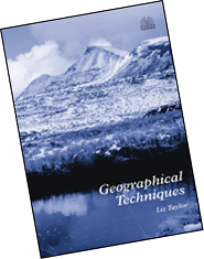
Geographical Techniques
Liz Taylor
- Explanation and practical exercises
- Accessible to all standards
- Designed for A-level and GCSE pupils
Essential skills for A-Level/Higher Tier GCSE
It is increasingly important for A-level and higher tier GCSE students to get to grips with a range of geographical techniques. This valuable publication offers departments a highly versatile and practical resource for introducing, reinforcing and revising essential techniques.
Departments could use individual sheets in lessons or compile sets of sheets to create their own booklets for use by different groups of students.
40 key techniques in self-contained units
The techniques used and the balance between sheets providing instruction and exercises is entirely up to the department.
Over 40 techniques are covered; these involve:
- primary fieldwork collection, eg writing questionnaires
- using secondary sources, eg photographs
- analysis, eg Spearman rank correlation
- presentation of data, eg proportional flow maps.
Each technique is covered in a self-contained unit. Each unit offers step-by-step instructions and a worksheet taking pupils through an exercise in that technique. These elements can be used together or separately. Many units are linked together to reinforce one another.
Contents
Teacher's notes
Techniques
- Chi-Squared Test
- Chloropleth Mapping
- Circular Graphs
- Coastal Surveys
- Cost-Benefit Analysis
- Cross-sections
- Describing Data
- Ecosystem Surveys
- Environmental Impact Assessment
- Environmental Quality Surveys
- Environmental Quality Survey - Pollution
- Field Sketches
- Interviews
- Isoline Maps
- Land Use Mapping
- Line and Bar Graphs
- Located Symbol Maps
- Location Quotients
- Nearest Neighbour Analysis
- Note-taking
- Ordnance Survey Maps
- Photographs
- Pictograms
- Pie Charts
- Population Pyramids
- Proportional Flow Maps
- Proportional Symbol Maps
- Questionnaires
- River Surveys
- Sampling Techniques
- Scattergraphs
- Secondary Sources
- Sieve Analysis
- Sketch Maps
- Slope Profiles
- Soil Surveys
- Spearman Rank Correlation
- Student's t-Test
- Tables
- Tabulation of Questionnaire Data
- Topological Maps
- Traffic Counts
- Triangular Graphs
- Values and Attitudes
- Weather Surveys
Geographical Techniques Booklet Cover Sheet
Index of Student Sheets
Online discount
This item is eligible for a 10% discount if ordered through this Web site. The price shown is the full price; the discount will be automatically calculated when you place an order.


